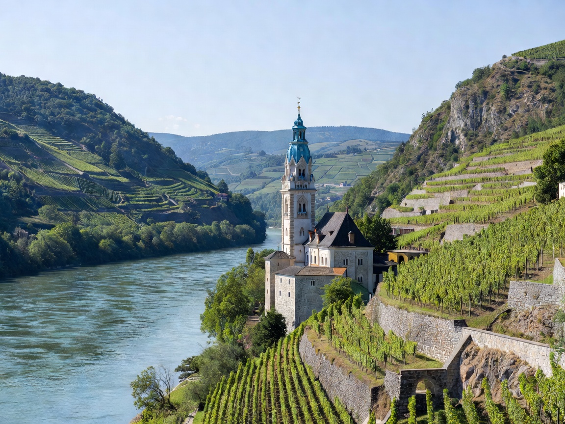
A River of Granite and Gneiss
The Austrian Danube enters from Germany at the confluence city of Passau, where the pale green waters of the Inn and the peaty black discharge of the Ilz merge into the Danube's blue-gray stream. As the river presses eastward through Upper and Lower Austria, it encounters the ancient crystalline rocks of the Bohemian Massif. Rather than skirting these granite uplands, the river has sliced directly through them, forming deep, winding gorges.
The most dramatic natural phenomenon in the upper sector is the Schlögener Schlinge, where the river performs a complete 180-degree loop within a tight canyon. Downstream, after passing the industrial harbor of Linz and the fertile Machland plains, the river enters the world-renowned Wachau Cultural Landscape between the historic river ports of Melk and Krems an der Donau. Here, the microclimate created by heat-retaining river terraces allows Grüner Veltliner and Riesling vines to thrive on slopes exceeding forty degrees.
By Boat: Navigating Locks and Vineyard Reaches
Navigating the Austrian Danube combines smooth, regulated impoundments with brisk free-flowing passages. Ten run-of-the-river hydroelectric power stations (such as Aschach, Wallsee-Mitterkirchen, and Melk) regulate the water levels for both energy generation and flood management. Each barrier features dual 24-meter-wide lock chambers capable of lifting or lowering large passenger vessels and commercial bulk carriers within twelve to fifteen minutes.
Between Melk and Krems, however, the river flows freely without dams for 36 kilometers to protect the pristine ecological and cultural integrity of the Wachau. Operating downstream from Melk toward Dürnstein, tour vessels and private motor cruisers glide smoothly with an assisted current of four to six kilometers per hour. Returning upstream demands substantial power output to overcome the river’s natural velocity, making downstream departures faster and more fuel-efficient. Small reaction ferries (Rollfähren)—attached to an overhead cable stretched across the river and propelled solely by the angle of the rudder against the current—still operate between Spitz and Arnsdorf as well as Weißenkirchen and St. Lorenz.
By Road: Twin-Bank Discovery on the B3 and B33
The Wachau and Strudengau sections are ideally suited for vehicular exploration due to well-maintained highways lining both riverbanks:
- The North Bank (Bundesstraße 3): Passing directly beneath the sheer granite promontory of Melk Abbey, the B3 runs along the northern bank through Spitz, Weißenkirchen, and Dürnstein. Stone retaining walls and centuries-old wine taverns (Heurigen) line the roadway, which provides frequent scenic pull-offs for photographing passing river traffic.
- The South Bank (Bundesstraße 33): For a quieter, less congested drive, the B33 skirts the southern bank from Melk to Krems through Aggsbach Markt and underneath the clifftop fortress ruins of Burg Aggstein. The road winds through orchards of Wachau apricots (Marillen) and offers expansive views across the river to the terraced vineyards of the opposite shore.
By Foot: The Welterbesteig Wachau and Donauradweg
For walkers and trekkers, Lower Austria provides infrastructure that ranks among the finest in Europe. The Welterbesteig Wachau is a 180-kilometer certified long-distance trail divided into 14 distinct stages. Unlike the paved bicycle paths at water level, the Welterbesteig ascends into the high vineyard terraces, traversing ancient oak woods, craggy rock outcroppings, and dry-stone wall systems.
Stage highlights include the climb from Spitz up the Tausendeimerberg (Thousand-Bucket Mountain), and the historic path connecting Dürnstein to the ruins of its medieval castle where England's King Richard the Lionheart was held prisoner in 1192. For those seeking continuous flat terrain, the riverside Donauradweg towpath provides paved, automobile-free walking on both banks, with scheduled passenger boats and cable ferries allowing hikers to craft custom loop itineraries.
Navigational Realities: Pros & Cons
Advantages
- Fully integrated public transit linking trains, passenger boats, and riverside buses.
- Overhead cable reaction ferries enabling river crossings without engines.
- Strict UNESCO zoning preserving architectural and landscape authenticity.
- World-class dry-stone trail maintenance throughout the Wachau corridor.
Challenges & Considerations
- Strict speed limits and wake controls for pleasure craft in the free-flowing reach.
- Summer weekend automotive traffic on the northern B3 highway can slow journeys.
- Advance bookings essential for hotel berths and day cruises during autumn harvest.
Seasonal Recommendations
The Wachau exhibits distinct personalities across three primary seasons. In mid-April, the valley floor turns white with apricot blossoms, signaling the resumption of full passenger boat schedules. Summer brings ideal conditions for river swimming in designated sandy coves near Aggsbach and Spitz. However, mid-September through late October is widely regarded as the pinnacle: the terraced vineyards turn brilliant shades of ochre and gold, morning mists drift above the Danube’s surface, and local vintners open seasonal tavern courtyards to celebrate the grape harvest.