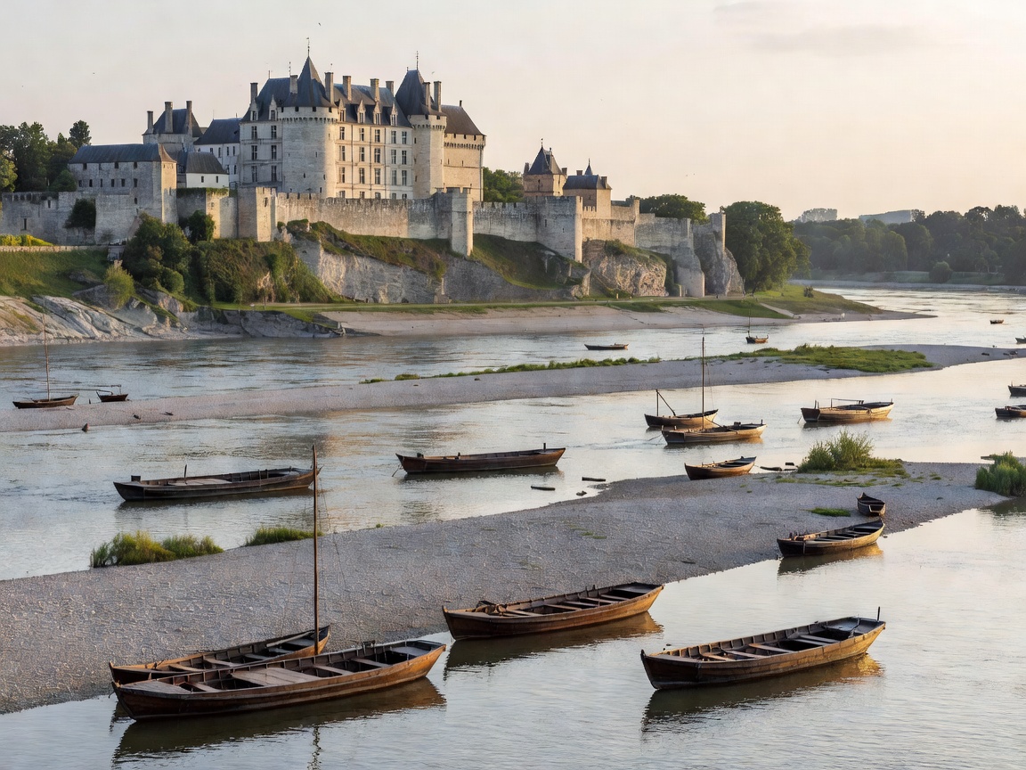
The Dynamics of a Wild Fluvial System
Unlike the Danube or the Rhine, which have been heavily canalized, dammed, and dredged to maintain standardized shipping lanes, the Loire remains predominantly untamed throughout its central basin. Originating in the volcanic Massif Central at Mont Gerbier de Jonc, the river flows north before making a sweeping westerly arc toward the Atlantic Ocean at Saint-Nazaire.
In the 280-kilometer UNESCO World Heritage stretch between Sully-sur-Loire and Chalonnes-sur-Loire, the riverbed is exceptionally wide and shallow. Water levels fluctuate drastically between torrential winter spates (les crues) and extreme summer droughts (l'étiage), when vast fields of golden limestone sandbars (les grèves) emerge. This natural dynamic makes the modern Loire impassable for commercial cargo barges, preserving an extraordinary ecosystem of migratory terns, beavers, and river fish.
By Boat: The Revival of Traditional Wooden Fluvial Craft
Because modern commercial vessels cannot navigate the shifting sandbars, river travel on the Loire relies on traditional flat-bottomed wooden craft designed over centuries to navigate waters only twenty to fifty centimeters deep:
- Gabares and Toues: Built from native oak and pine, these historic wooden boats feature flat hulls, broad square bows, and large canvas square-rigged sails to catch prevailing Atlantic westerly breezes. Today, nautical associations in Orléans, Blois, Chaumont-sur-Loire, and Saumur offer guided expeditions aboard these replicas.
- Toue Cabanée: A traditional fisherman's boat fitted with a small wooden cabin on deck. Originally used by salmon and eel fishermen, these boats now serve as distinctive mobile research and passenger craft for exploring uninhabited alluvial islands and observing colonies of little terns.
- Paddle Craft: The Loire is one of Europe's premier wilderness canoe-camping rivers. Paddlers can embark on multi-day journeys, pitching temporary bivouac camps on designated public sand islands (strictly respecting seasonal bird-nesting closures between April and July).
By Road: Along the Crown of the Levées
The geography of road travel along the Loire is intimately bound to centuries of flood engineering. Following devastating floods throughout the Middle Ages, the French Crown constructed massive stone-reinforced earthen dykes known as les levées. Today, the most scenic riverside roads run directly on top of these embankments:
Driving the D951 and D952 routes places motorists at elevated eye-level with both the flowing riverbed on one side and the sunken fertile agricultural valleys (le val) on the other. Passing through towns like Langeais, Saumur, and Montsoreau, the roads run beneath sheer bluffs of creamy tuffeau limestone. These cliffs are riddled with troglodytic cave dwellings, mushroom farms, and cellars producing sparkling Crémant de Loire and Cabernet Franc wines.
By Foot: The GR 3 and the Grand Towpath Network
The Sentier de Grande Randonnée 3 (GR 3) was the very first official long-distance footpath established in France, and it tracks the course of the Loire from source to sea. Walking the Loire corridor is remarkably accessible due to the flat gradients of the riverbanks and former horse-towpaths.
The segment between Amboise and Tours provides level walking through riparian willow forests, with detours leading up into the vineyards of Vouvray. For hikers seeking dramatic architectural stops, the footpath connects directly to the gardens of Chaumont-sur-Loire, the fortress walls of Chinon on the tributary Vienne, and the Château de Villandry with its legendary Renaissance terraced gardens. Walkers should note that unlike canal towpaths, the natural Loire path occasionally diverts inland around marshy backwaters (les boires) during periods of high water.
Navigational Realities: Pros & Cons
Advantages
- Pristine wilderness character without industrial shipping noise or locks.
- Over 800 kilometers of continuous flat walking and cycling along La Loire à Vélo.
- Unmatched concentration of Renaissance royal châteaux directly accessible from paths.
- Exceptional troglodyte cave cellars and cultural stops along river bluffs.
Challenges & Considerations
- No scheduled deep-draft motor passenger cruise connections between major towns.
- Shifting underwater sandbars create dangerous hidden drop-offs and currents.
- Wild swimming is strictly prohibited in most reaches due to treacherous eddies.
Field Planning & Seasonal Timing
The optimal season for exploring the Loire Valley spans from late April to late October. Spring brings blossoming orchard meadows and higher water volumes that animate the main channel. Mid-summer (July and August) exposes expansive sandbars ideal for observing wading birds, though afternoon temperatures in the limestone valley can be high. Autumn brings crisp mornings, amber foliage on vineyard hillsides, and the famous roaring of stags (le brame du cerf) in the royal forest reserves surrounding Chambord.