From Raging Torrent to Stepped Hydro Corridor
Before the late 20th century, the Douro (Spanish: Duero) was infamous as one of the most perilous rivers in Europe. As it rushed from the high Spanish plateau through deep granite and schist gorges down to the Atlantic Ocean, the river plummeted over treacherous rapids, submerged boulders, and narrow bottlenecks like the notorious Cachão da Valeira. For centuries, brave crews navigated wooden barcos rabelos—open-decked sailing barges with massive steering sweeps—carrying barrels of fortified Port wine downstream to the cellars of Vila Nova de Gaia.
Between 1970 and 1985, a massive Portuguese hydroelectric project transformed the river into a series of stepped, tranquil lakes. Five major dams—Crestuma-Lever, Carrapatelo, Bagaúste, Valeira, and Pocinho—now control the 210-kilometer waterway up to the Spanish frontier at Barca d'Alva. The lock at Carrapatelo Dam is particularly astonishing: with a lift of 35 vertical meters, it ranks among the deepest single navigational lock chambers in Europe.
By Boat: Hotel Cruisers and Day Passages
Today, the tamed Douro offers one of the world's most serene river cruising experiences. Because all commercial locks accommodate vessels up to 83 meters long and 11.4 meters wide, purpose-built hotel ships and day cruisers operate along the full length of the waterway from March through November.
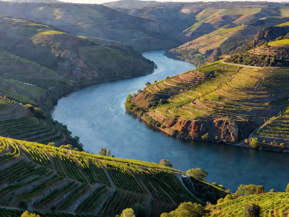
The journey begins under the soaring iron arches of Porto’s Dom Luís I Bridge. Leaving the coastal humidity behind, ships pass through the lower river's eucalyptus-forested hills before entering the dramatic, sun-drenched microclimate of the Alto Douro. Past the town of Peso da Régua, the scenery shifts entirely: granite yields to dark, flaky schist, and the valley walls rise sharply in rhythmic terraced bands. At Pinhão, traditional wooden rabelo boats, now converted for passenger day trips, ferry travelers into narrow tributary gorges like the Rio Pinhão and Rio Tua.
By Road: Navigating the Estrada Nacional 222
Driving along the Douro requires careful handling and patience, as roads hug steep mountain contours high above the canyon floor:
- Estrada Nacional 222 (EN 222): The 27-kilometer section connecting Peso da Régua to Pinhão has frequently been praised by motoring enthusiasts for its uninterrupted riverbank curves. The roadway runs at water level, passing the white-washed gateposts of historic port quintas before climbing into panoramic vineyard switchbacks toward São João da Pesqueira.
- The High Miradouros: To grasp the monumental scale of the landscape, drives must ascend to high viewpoints. The Miradouro de São Salvador do Mundo provides an extraordinary view over the flooded canyon of the Cachão da Valeira, while Casal de Loivos above Pinhão presents an iconic perspective of the river looping through terraced amphitheaters.
By Foot: Quinta Trails and the Old Rail Corridors
Hiking in the Douro differs fundamentally from the level towpaths of Central Europe. Because the canyon walls plunge straight into deep water, there is no continuous flat towpath along the main riverbed. Instead, pedestrian exploration takes two distinct forms:
First, estate paths crisscross the steep terraced vineyards. Trailheads in Pinhão, Provesende, and Trevões lead walkers through ancient schist villages, up historic stone stairways (socorcos), and along irrigation channels. The climbs are steep and demanding, but reward hikers with quiet vistas of olive groves and orange trees growing beside old stone walls.
Second, walkers can follow preserved sections of the Linha do Douro railway corridor and its abandoned branch lines, such as the Tua Valley trail. The main active railway line still hugs the river's northern edge from Porto all the way to Pocinho, offering hikers a unique opportunity to walk one-way between small hillside stations and return easily by vintage diesel train.
Navigational Realities: Pros & Cons
Advantages
- World's deepest single river lock experience at Carrapatelo (35m lift).
- Remarkable river views from the Linha do Douro train line hugging the shoreline.
- Exceptional regional culinary traditions and world-renowned vineyard estate visits.
- Calm, lake-like waters completely free of strong cross-currents or turbulent rapids.
Challenges & Considerations
- Extreme summer afternoon temperatures often exceeding 38°C (100°F) in July and August.
- No continuous flat river-level walking trail along the main canyon floor.
- Narrow, winding roads demand heightened driver concentration and slow average speeds.
Field Planning & Seasonal Timing
The Douro experiences stark continental weather variations. Winters are cool and damp, and scheduled passenger cruises typically pause for annual lock maintenance between December and late February. Spring (April and May) is mild and green, with almond blossoms covering the eastern slopes of the Douro Superior. However, late September to mid-October during the grape harvest (vindima) is the most vibrant period: the terraces turn deep crimson and gold, and the sweet aroma of fermenting grapes drifts through the valley air.